


An Interactive 5-Day Training Course
The Complete Geomodeling Course
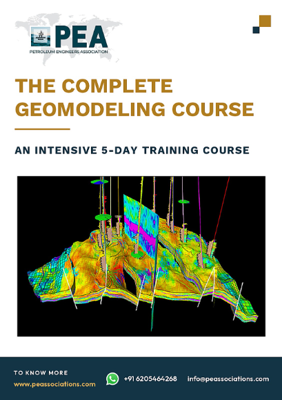
End to end 3D reservoir geomodeling workflow
Secure your spot now!
Duration
5 Days
Price
$ 4,500
Starting From
05 Apr 2027



The Complete Geomodeling Course
Have Questions ?
The Complete Geomodeling Course - RE-GEOM-PEA27
| Code | Date | Time | Duration | Location | Currency | Early Bird Fee Per Person |
|---|---|---|---|---|---|---|
| RE-GEOM-PEA27 | 05 - 09 Apr 2027 | 10 AM CST | 4 Hours Per Day |
Online |
USD |
4500 |
Need this for a group? We deliver the same course in-house — face-to-face at your location or online — tailored to your assets and team level. Contact info@peassociations.com.
Boost your team's skills and your budget! Enjoy group discounts for collaborative learning. Send an inquiry to info@peassociations.com.
The Complete Geomodeling Course
Description
A geological model is the point where every piece of subsurface data is forced to agree with every other piece. Seismic interpretation defines the structure, wells give hard data at a handful of points, cores and logs describe the rock, and depositional interpretation supplies the geometry between the wells. The model must honour all of it simultaneously and remain geologically credible in the vast volume where nothing has been measured. When that is done well, the model carries the volumetrics, the well planning and the simulation study. When it is done badly, it produces a number that is defended for years because nobody can trace where it came from.
This course covers the full workflow. It begins with data inventory, well correlation and quality control, then builds the structural framework from faults and horizons, establishes the stratigraphic zonation, and designs a 3D grid whose resolution and layering match the depositional geometry rather than convenience. It then covers log blocking, spatial statistics and variogram analysis, facies modelling by deterministic, object-based, pixel-based and multi-point methods, petrophysical property modelling with trends and secondary data, saturation height modelling and contact definition, volumetric calculation with structural, property and contact uncertainty, upscaling to a simulation grid, and the quality control and documentation standards that make a model defensible. Each stage is examined for the decisions that most affect the final volume.
Demo Class
Geomodeling turns interpretation into geometry. Before a model exists, the subsurface team holds a set of separate views: a seismic interpretation with its own depth uncertainty, a set of well correlations, a petrophysical evaluation, a sedimentological description and a fluid contact interpretation. Each of these is defensible on its own. The model is where they must be reconciled into a single three dimensional description that can be counted, drilled and simulated.
The technical difficulty is that the model is overwhelmingly interpolation. Well data occupies a negligible fraction of the reservoir volume; the rest is filled by an algorithm operating under a set of statistical and geometric rules chosen by the modeller. Those choices — grid resolution, layering scheme, variogram ranges, facies proportions, trend surfaces, saturation function — determine the outcome as much as the data does. Two competent geomodellers given identical data can produce models whose hydrocarbon volumes differ by tens of percent, and both models can honour every well.
That is not a flaw to be eliminated but a property to be managed. It requires the modeller to understand what each algorithm assumes, to constrain the model with geological reasoning rather than statistics alone, to test the sensitivity of the volume to the choices made, and to document those choices so that a reviewer can follow the reasoning. It also requires the model to be built for its purpose: a model for volumetrics, a model for well planning and a model destined for flow simulation are not the same object. This course develops the workflow and the judgement to build all three properly.
By the end of this training, participants will be able to:
- Assemble, validate and correlate well, seismic and petrophysical data into a consistent modelling dataset
- Construct a structural framework from fault interpretation and depth-converted horizons and check it for geometric consistency
- Define a stratigraphic zonation and layering scheme that reflects the depositional architecture of the reservoir
- Design a three dimensional grid with resolution, orientation and layering appropriate to the model purpose
- Block well logs to the grid without destroying the property distribution the model must reproduce
- Perform variogram analysis and select spatial statistical parameters supported by data and geological reasoning
- Build facies models using deterministic, object-based, pixel-based and multi-point methods and select the appropriate approach
- Populate petrophysical properties using geostatistical methods conditioned to facies, trends and secondary data
- Apply saturation height functions and fluid contact definitions to produce a consistent saturation distribution
- Calculate in-place volumes with structural, property and contact uncertainty, and upscale the model for flow simulation
The course is delivered as a complete workflow programme, following a reservoir from raw data through to a simulation-ready model. Each stage is introduced through the geological and statistical principles that govern it, then taken through the practical decisions the modeller has to make, then examined for its effect on the final volume and on flow behaviour. Field cases are drawn from clastic and carbonate reservoirs with different depositional settings and data densities, including cases where the model was later shown to be wrong by subsequent drilling. Quality control checkpoints are built into every stage rather than left to the end, and model documentation and handover standards are treated as part of the technical work.
Organisations sending participants to this training will:
- Produce in-place volume estimates that can be traced, reviewed and defended under technical audit
- Improve well planning and infill targeting through models that represent reservoir architecture realistically
- Reduce the disconnect between static and dynamic models and shorten the history matching effort
- Establish a consistent modelling standard so models built by different staff can be compared and inherited
- Strengthen internal capability to review consultant and partner models rather than accept them as delivered
- Support better development decisions by quantifying, rather than hiding, subsurface uncertainty
Participants will:
- Carry out the full static modelling workflow independently from data loading to upscaled grid
- Understand how each modelling choice propagates into the final hydrocarbon volume
- Select modelling algorithms on geological grounds instead of defaulting to whatever was used last time
- Recognise when a model is honouring the data superficially but violating the geology
- Quantify and communicate uncertainty in a form decision makers can use
- Work more effectively with reservoir engineers, petrophysicists and seismic interpreters
- Geomodellers and reservoir geologists
- Development and production geologists
- Geophysicists moving from interpretation into reservoir characterisation
- Petrophysicists supplying property inputs to static models
- Reservoir engineers who use, review or upscale geological models
- Subsurface team leads and technical managers approving model-based volumes
- Graduate geoscientists entering reservoir modelling roles
Module 1 — Geomodeling Framework and Project Design
- Purpose-driven modelling: volumetrics, well planning and simulation models
- The static modelling workflow and its dependencies
- Scale of investigation from pore to field and the averaging involved
- Deterministic and stochastic approaches and when each applies
- Model resolution decisions and their consequences
- Project setup, coordinate systems, datums and depth references
- Roles, data handover points and team interfaces
Module 2 — Data Inventory, Preparation and Quality Control
- Well header, deviation survey and checkshot validation
- Log data conditioning, depth matching and splicing
- Petrophysical interpretation review: porosity, saturation and net cut-offs
- Core data integration and core-log calibration
- Seismic interpretation inputs, horizons, faults and attribute volumes
- Velocity models, depth conversion and residual mis-tie handling
- Data uncertainty assessment before modelling begins
Module 3 — Stratigraphic Correlation and Zonation
- Sequence stratigraphic framework and correlation surfaces
- Chronostratigraphic versus lithostratigraphic correlation
- Well-to-well correlation in faulted and stratigraphically complex settings
- Marker picking, quality control and consistency checking
- Zone definition and its influence on property distribution
- Depositional environment interpretation and its geometric implications
- Reservoir architecture concepts by depositional setting
Module 4 — Structural Modelling: Faults and Horizons
- Fault interpretation transfer from seismic to model
- Fault stick editing, fault plane construction and truncation rules
- Fault network topology, branching and relay structures
- Horizon gridding and honouring well markers
- Isochore and isopach construction and conflict resolution
- Structural framework consistency and geometric validation
- Depth uncertainty and its effect on gross rock volume
Module 5 — 3D Grid Design and Construction
- Grid geometry types and their strengths and limitations
- Areal cell size selection and orientation relative to structure and flow
- Corner point geometry and pillar construction across faults
- Layering schemes: proportional, follow-base, follow-top and their geological meaning
- Vertical resolution and the preservation of thin beds
- Grid quality control: cell distortion, negative volumes and pinch-outs
- Grid design differences between static and simulation grids
Module 6 — Well Log Blocking and Scale Transfer
- Blocking logs into grid cells and averaging methods by property type
- Arithmetic, geometric and harmonic averaging and when each applies
- Preserving facies proportions and property histograms during blocking
- Effect of layering on blocked log representativeness
- Handling deviated and horizontal wells in blocking
- Bias introduced by uneven well sampling
- Validation of blocked logs against original curves
Module 7 — Spatial Statistics and Variogram Analysis
- Univariate statistics, histograms and distribution transformation
- Stationarity, trends and their removal before variography
- Experimental variogram calculation, lag design and pair counts
- Variogram models: spherical, exponential, Gaussian and nugget
- Range, sill and anisotropy in horizontal and vertical directions
- Vertical variograms from wells and horizontal ranges from analogues and seismic
- Practical variogram selection where data are sparse
- Kriging principles and their role in property modelling
Module 8 — Facies and Lithology Modelling
- Facies scheme definition and its link to petrophysical behaviour
- Deterministic facies modelling and interpretive control
- Object-based modelling: body geometry, dimensions and proportions
- Sequential indicator simulation and truncated Gaussian methods
- Multi-point statistics and training image construction
- Vertical proportion curves and areal trend maps as constraints
- Conditioning facies models to seismic attributes and probability volumes
- Selecting a facies method by depositional setting and data density
- Quality control against well data and geological expectation
Module 9 — Petrophysical Property Modelling
- Property modelling within facies versus across the whole model
- Sequential Gaussian simulation and its parameter controls
- Kriging, cokriging and collocated cokriging with secondary data
- Porosity-permeability relationships and permeability modelling strategy
- Trend modelling: depth, compaction, structural and areal trends
- Seismic-derived property constraints and impedance-porosity relationships
- Realisation generation, ranking and selection
- Property model validation against wells, histograms and geological reasoning
Module 10 — Saturation Modelling and Fluid Contacts
- Fluid contact interpretation from pressure, log and test data
- Free water level, oil-water contact and transition zone definition
- Capillary pressure data and its conversion to reservoir conditions
- Saturation height function derivation and rock typing
- Applying saturation height functions in the 3D model
- Consistency between log-derived and model saturations
- Contact uncertainty and compartment-specific contacts
Module 11 — Volumetrics and Uncertainty Analysis
- In-place volume calculation from the 3D model
- Net cut-off application and its effect on reported volume
- Deterministic base case and reasonable low and high cases
- Structural, property, facies and contact uncertainty parameters
- Experimental design and multiple realisation workflows
- Volume distribution, P90, P50 and P10 reporting
- Sensitivity ranking and identification of the dominant uncertainties
- Reconciling model volumes with independent volumetric estimates
Module 12 — Upscaling, Model Validation and Handover
- Purpose of upscaling and information loss at coarser scale
- Coarse grid design for flow simulation
- Static upscaling of porosity, net-to-gross and facies
- Permeability upscaling, flow-based methods and directional permeability
- Preserving connectivity and flow behaviour through upscaling
- Validation of the coarse model against the fine model
- Model quality control checklist across the full workflow
- Documentation, assumption registers and handover to reservoir engineering
- Model updating as new wells and data arrive
Upon successful completion of this training course, delegates will be awarded an official Certificate of Completion issued by the Petroleum Engineers Association (PEA), an ISO 9001:2015 certified training organization. The certificate carries 10 Credits and formally records the total learning hours completed.
Each certificate is signed by the Course Facilitator and the CEO of the Petroleum Engineers Association, and serves as verifiable proof of professional training that delegates can present to employers and professional bodies worldwide.
Your expert course leader is a senior petroleum engineering consultant, certified trainer and university lecturer with more than 25 years of experience, specialising in three dimensional reservoir geomodeling.
His technical expertise covers structural framework construction, stratigraphic zonation, grid design, facies and property modelling, saturation height functions, volumetrics, uncertainty analysis and upscaling across the full geomodeling workflow.
He has provided consulting and technical support to international operators and national oil companies across the Middle East, North Africa, Asia Pacific and the Americas, working on static reservoir model builds, structural and property model reviews, volumetric assessments and uncertainty analysis projects across a range of asset types.
He has designed and delivered technical training programmes on reservoir geomodeling topics for operating companies and service providers, conducting both classroom and online sessions for engineers and technical staff across the Middle East, Asia Pacific, Africa and Europe.
Frequently Asked Questions
All course bookings made through PEA are strictly non-refundable. By registering for a course, you acknowledge and accept that all fees are payable in full and are not subject to refund under any circumstances, including changes in personal or professional commitments or partial attendance.
PEA reserves the right to make reasonable adjustments to course content, trainers, or schedules where necessary, without entitling delegates to a refund. Comprehensive details of each course — including objectives, target audience, and content — are clearly outlined before enrolment, and it is the responsibility of the delegate to ensure the course's suitability prior to booking.
For any inquiries related to cancellations or bookings, please contact our support team, who will be happy to assist you.
